|
 -
General Description -
General Description
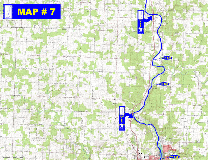
o Miles 138 - 143 (Merrill dam to I-39 bridge) Just below the dam
is a easily navigated rapids leading to the wide river with steady
current
o Miles 143 - 153 (I-39 bridge to Marathon County WW bridge) Current
stays steady & slow up to easily navigated Trappe Rapids where
the channel narrows and current increases at Granite Heights
o Miles 153 - 155 (Marathon County WW bridge to Gilbert Park) River
slows due to influence of the Wausau dam and continues through increasingly
developed shoreline
- Portages (see portage maps by clicking on the dam symbol)
o Mile 153 Optional portage around the old Brokaw dam below County
WW bridge - easy access to the right bank before the concrete abutments
where the dam was located
- Landings suitable for take-out or put-in
o Mile 138 Riverside Park boat landing just below the Merrill dam
(right)
o Mile 147 Access on Pine Bluff Rd off County W (left)
o Mile 150 Granite Heights access (left)
o Mile 155 Gilbert Park boat landing on the north side of Wausau
(left)
- Camping - No known campgrounds on this stretch of river
- Other amenities
o Mile 138 - Riverside Park with water available, boat landing,
restrooms, playground, picnic area & shelter (right)
o Mile 155 - Gilbert Park with boat landing, picnic tables, fishing
pier and parking available off Sixth Street in Wausau (left)
- Flow Information - For flow information on river flow below Merrill go to http://waterdata.usgs.gov/wi/nwis/uv/?site_no=05395000&PARAmeter_cd=00065,00060 or go to content.cfm?PageID=84&Cat=0
|


 -
General Description