|
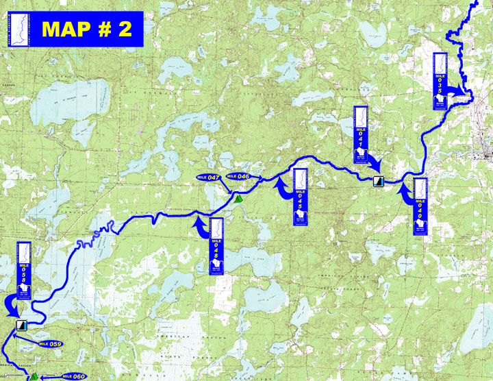
WISCONSIN RIVER CENTENNIAL TRAIL MAP #2 River Rd to Rainbow Dam |
|
|
 -
General Description -
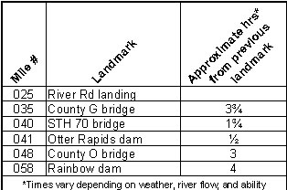
General Descriptiono Miles 025 - 035 (River Rd landing to Vilas County G) River continues through marshy lowlands, be on guard for deadfall o Miles 035 - 040 (Vilas County G to STH 70) Little current, heavy boat traffic through Watersmeet Lake where the Eagle River and other tributaries enter o Miles 040 - 041 (STH 70 to Otter Rapids dam) Gently meandering, easy to canoe o Miles 041 - 048 (Otter Rapids dam to Oneida County O) Tailwater area is fast with many boulders, narrow river channel through wooded uplands and marshy lowlands to beginning of flowage above O Bridge o Miles 048 - 058 (Rainbow Reservoir) Winds can make crossing the 4,165 acre reservoir very difficult - Portages (see portage maps by clicking on the dam symbol) - Landings suitable for take-out or put-in - Camping - Other amenities - Flow Information - For flow information on river flow below Otter Rapids go to http://www.wisconsinpublicservice.com/environment/hydrodata.aspx” and for flow information on river flow below Rainbow go to http://waterdata.usgs.gov/wi/nwis/uv/?site_no=05391000&PARAmeter_cd=00065,00060.
|
 |